Public transport to Lace Market Square is very good, so first consider whether it’s worth bringing your car into town at all.
If you’re relatively mobile once you leave the car, your cheapest option is likely to be using a Park and Ride car park and coming in on bus or tram.
All Nottingham trams are flat access; many buses have wheelchair access via a ramp. If you get a good spot at the Park and Ride, this compares well for distance with using the car parks in town, since the tram stop is nearer to the Square than the car parks are.
Dropping off, with Blue Badge
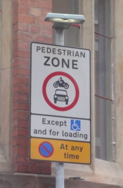
Access by road to Lace Market Square is along St Mary’s Gate. The road is a pedestrian zone; the only vehicles allowed are Blue Badge holders and for loading.
How easy it would be to drive in there during an event, I don’t know, because of perhaps needing to get throngs of pedestrians to move out of the way. But in principle, it’s allowed, so this is the nearest dropping-off point by car.
Parking is officially not allowed, at any time, even for Blue Badge holders.
The approach to St Mary’s Gate by car is via Fletcher Gate and then via Warser Gate.
(Pedestrians can also approach via Stoney Street, but not vehicles – there’s a little bit of one-way system there.)
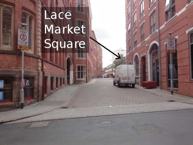
Here’s the turning from Fletcher Gate onto Warser Gate, just by Lace Market tram stop. The photo just about shows the Lace Market tram stop sign.
Note also the one-way sign for Warser Gate, just visible over the top of the van making the turn.

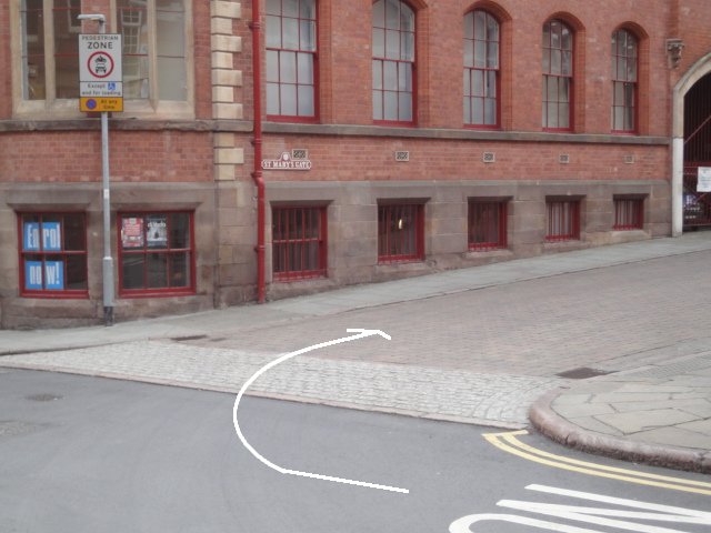
From Warser Gate, turn right onto St Mary’s Gate.

The building on the corner is a handy landmark – with red windowframes and guttering pipes (as at July 2015).
The road sign for the start of St Mary’s Gate says, in text and symbols:
Pedestrian zone. No vehicles except Blue Badge and for loading. No parking at any time.
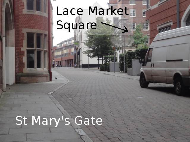
Heading along St Mary’s Gate, Lace Market Square is on the right.
The grey stony lumps on the right hand (west) side of the road represent the edges of the square. At Notts Pride 2014, that’s more or less where they put the main entrance into the centre of the square – i.e. where there was a gap in the temporary fencing, with people checking wristbands.
Parking, with or without Blue Badge
Stoney Street car park (NCP) is the nearest to Lace Market Square. From its Blue Badge spaces to the Square, via St Mary’s Gate, the distance is about 80 or 90 metres.
Also worth considering is Lace Market car park, on Pilcher Gate, which is almost as close, and a lot cheaper. For example, at Stoney Street, two hours is £7.50. At Lace Market, it’s £3.80. (Other prices for both are given below.) From Lace Market car park’s blue badge spaces up to the Square, it’s about 130 or 140 metres, including some uphill.
Neither of these car parks gives any free time to Blue Badge holders.
A third option, albeit with some limits, is to park at Broadmarsh Shopping Centre and borrow a scooter or powered wheelchair from Shopmobility Nottingham. Limits include: sign up in advance; return all equipment by 4pm; doesn’t include Sundays. I haven’t done roaming research on this, only read the page linked there.
More on the Lace Market car park further down the page (that’s the cheaper one); first, here’s info on getting to the Stoney Street one (nearest).
Stoney Street car park to Lace Market Square
Map: King Street leads off Stoney Street to the entrance to Stoney Street car park.
Map: approx location of pedestrian exit from Stoney Street car park onto St Mary’s Gate.
Stoney Street car park is connected with Stoney Street itself via a small street called King’s Place. You can approach from either direction on Stoney Street.
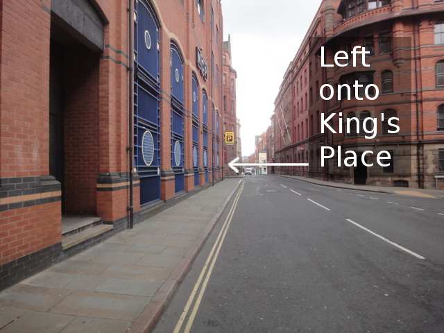
From the north along Stoney Street, it’s a left turn…
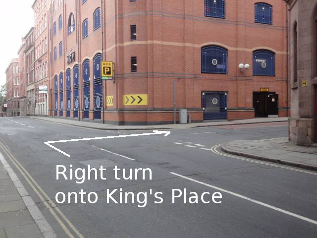
From the south along Stoney Street, it’s a right turn…
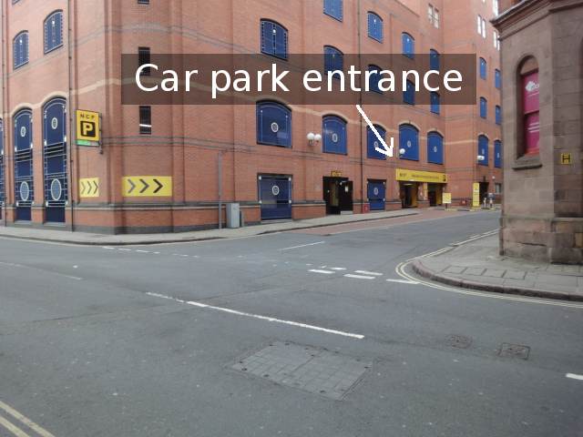
In King’s Place, the entrance to the car park is on the left.
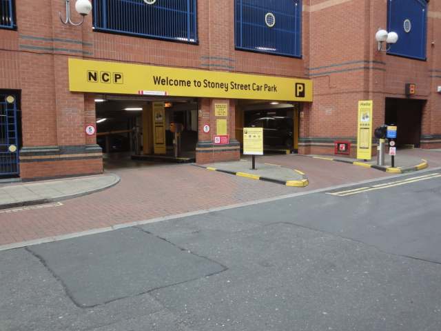
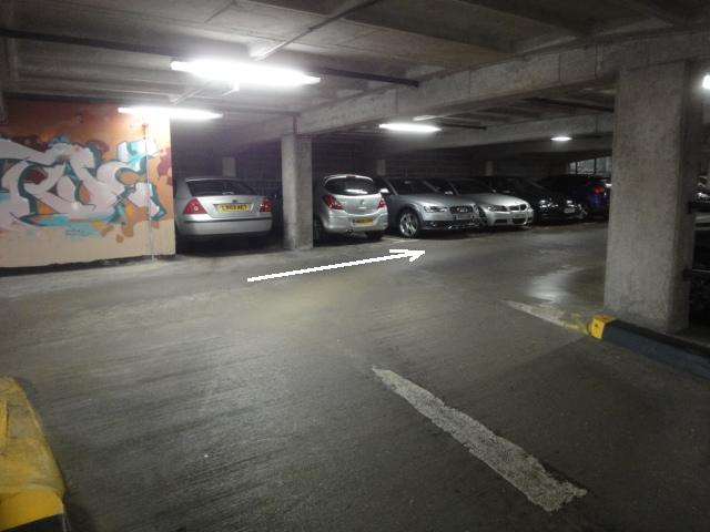
As you get inside the car park, it’s left turn only.
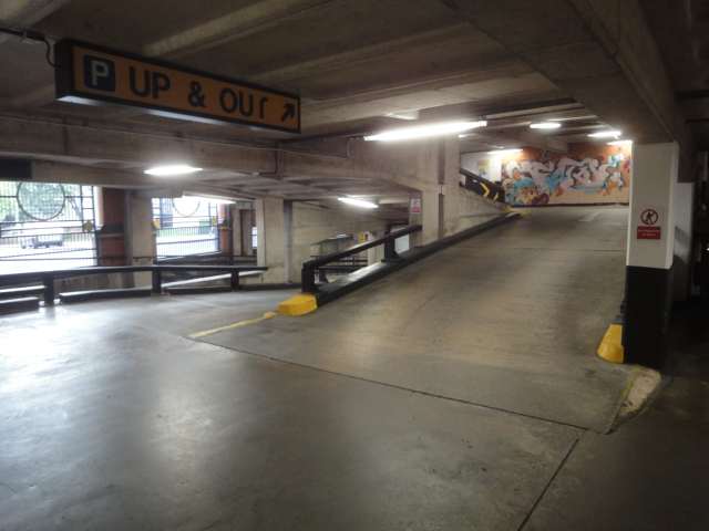
As you turn left after the barrier, the ramp upwards is already visible.
The sign pointing up the ramp says “UP & OUT”. At the top of the ramp is some graffiti art.
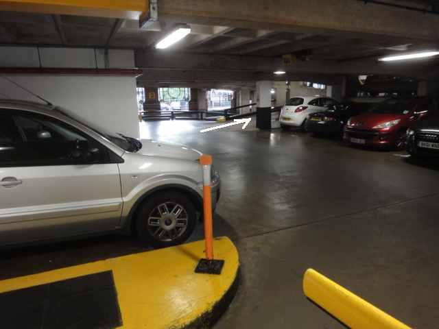
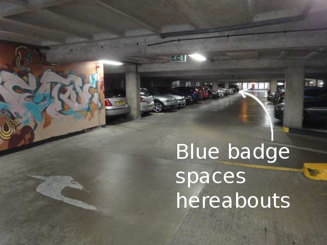
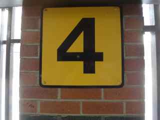
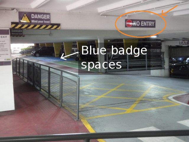
Turn right at the artwork. You’re now on “Level 4”.
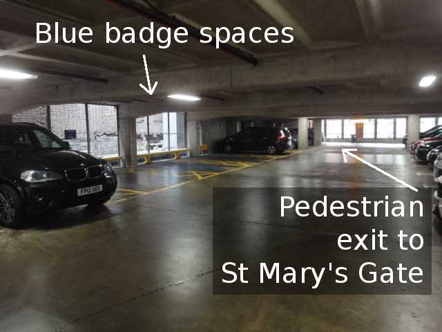
As you look along the space, the Blue Badge spaces are near the far end on the left.
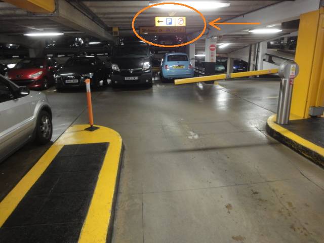
At the far end, past the Blue Badge spaces, is the pedestrian exit onto St Mary’s Gate.
Oddly, the sign by the exit says “Stairs to St Mary’s Gate”. This is misleading, because the exit is flat…
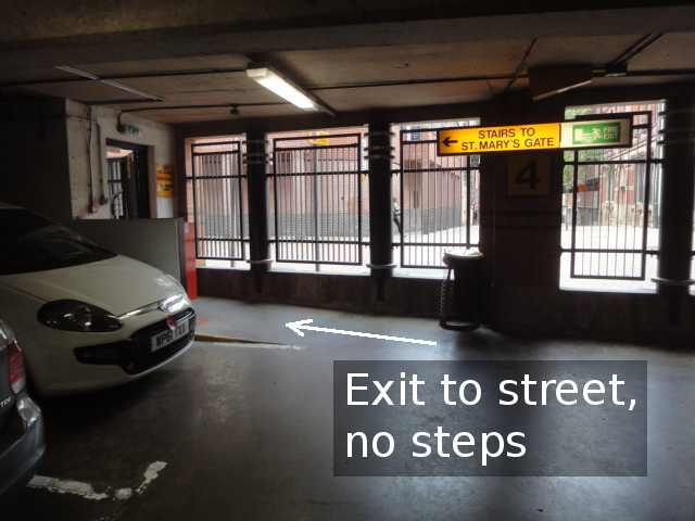
… as can be seen in the next photo.
(There are some stairs nearby, leading to other floors of the car park – so if they use identical signs on all the floors, the wording would make sense on the other floors.)
Another sign reminds you that ground level is known as level 4.
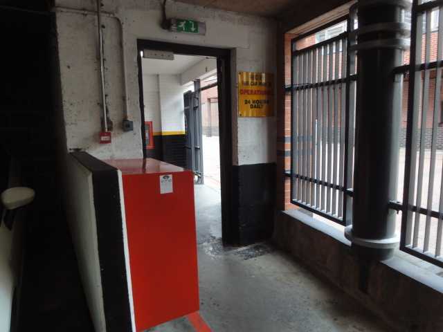
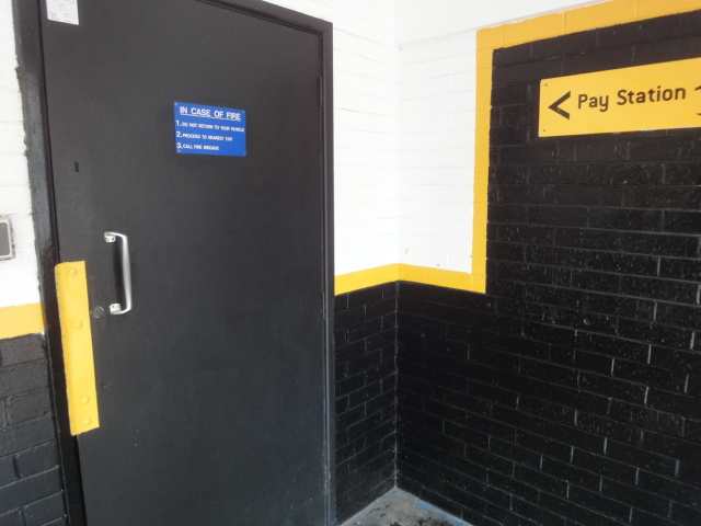
In between the car parking area and the street is a sort of hallway or lobby. To the left of this hallway as you come out is a black door leading to an inner hallway with the ticket machine. They call it a “Pay Station”.
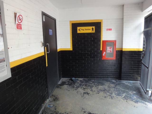
Unfortunately, you have to open the door towards you, and it’s sprung, which I think could be a bit tricky for some wheelchair users. However, the spring is a relatively gentle one compared to some I’ve used – I didn’t feel I was having to fight it.
In this pic, as well as the door spring, you can see the ticket machine through the doorway.
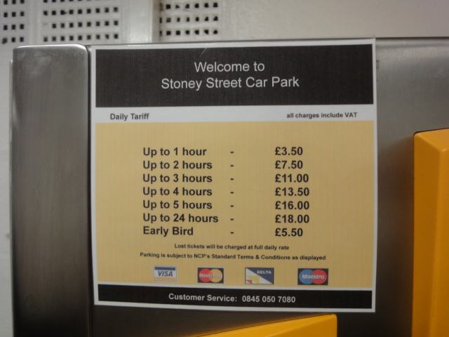
Text as shown on pricing sign:
Up to 1 hour – £3.50.
Up to 2 hours – £7.50.
Up to 3 hours – £11.00.
Up to 4 hours – £13.50.
Up to 5 hours – £16.00.
Up to 24 hours – £18.00.
Early Bird – £5.50.
Lost tickets will be charged at full daily rate.
Parking is subject to NCP’s Standard Terms & Conditions as displayed.
Customer Service: 0845 050 7080.
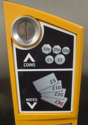
Coins, notes and cards they will accept: 10p, 20p, 50p, £1, £2, £5, £10, £20, debit or credit cards. Credit cards incur a 2.5% surcharge. Note that 1p, 2p, 5p or £50 cash can not be used.
As you leave onto St Mary’s Gate, turn right.
Lace Market Square is along St Mary’s Gate on your left, about 70 metres away.
Back to Lace Market Square main page
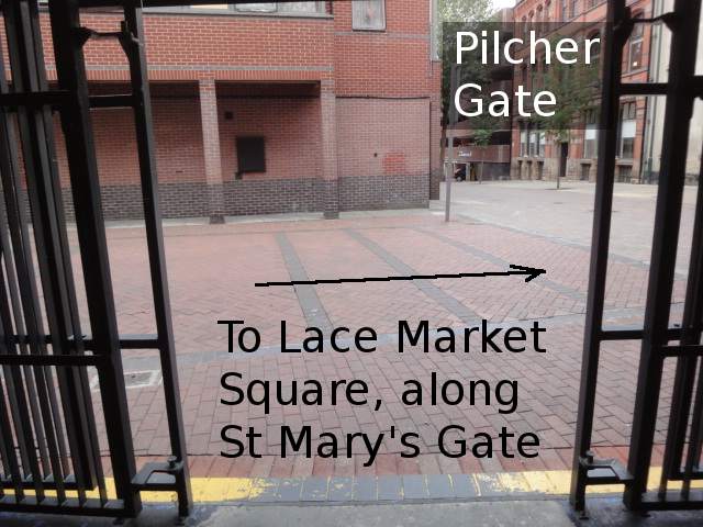
Lace Market car park to Lace Market Square
The cheaper of these two nearby car parks, run by Nottingham City Council, is Lace Market car park.
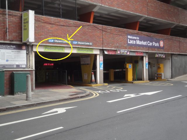
This is approached along Pilcher Gate, via a turning off Fletcher Gate.
Next photo shows Fletcher Gate, facing north, with the turn-off to Pilcher Gate on the right.
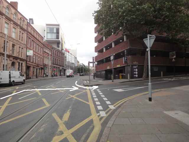
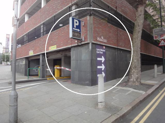
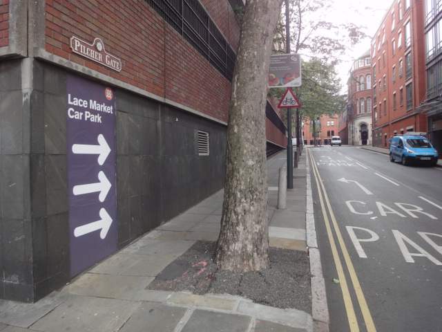
There’s a big blue “P” sign on the corner. From the south, you can also see a purple sign with the car park name and three big white arrows.
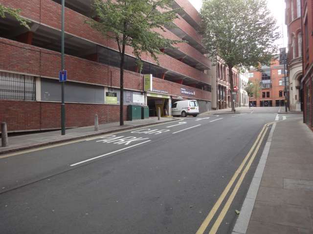
Up Pilcher Gate, get in the left hand lane for the car park.
In the next pic, a van is going into the vehicle entrance.
Note the pedestrian entrance – which is also the pedestrian exit you’ll be coming out at.
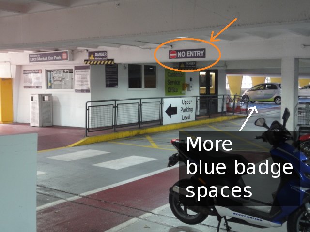
The blue badge spaces are on the left as you come in. But you can’t turn straight towards them; you have to go right and loop round. (Sorry, no photos for the loop round.)
A second set of blue badge spaces are opposite the first, not immediately visible when you first come in.
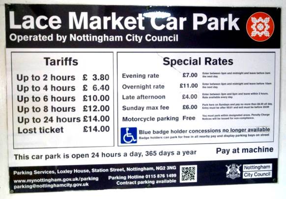
Text as shown on pricing sign:
Lace Market Car Park
Operated by Nottingham City Council.
Tariffs
Up to 2 hours – £3.80.
Up to 4 hours – £6.40.
Up to 6 hours – £10.00.
Up to 8 hours – £12.00.
Up to 24 hours – £14.00.
Lost ticket – £14.00.
Special Rates
Evening rate – £7.00. Enter between 5pm and midnight and leave before 2am the next day.
Overnight rate – £11.00. Enter between 5pm and midnight and leave before 10am the next day.
Late afternoon – £4.00. Enter between 3pm and 5pm and leave within 3 hours. Rate available every day.
Sunday max fee – £6.00. Park here on Sundays and pay no more than £6.00 all day. Entry must be after 00:01 and exit must be before 23:59.
Motorcycle parking – Free. You must park within designated areas. Penalty Charge Notices will be issued for non-compliance.
Blue badge holder concessions no longer available.
Badge holders can park for free in all nearby pay and display parking bays on street.
This car park is open 24 hours a day, 365 days a year.
Pay at machine.
Parking Services, Loxley House, Station STreet, Nottingham, NG2 3NG.
www.mynottingham.gov.uk/parking
parking@nottinghamcity.gov.uk
Parking Hotline 0115 876 1499
Contract parking available
Nottingham City Council.
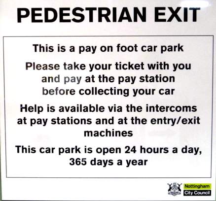
Text as shown on payment sign:
Pedestrian Exit
This is a pay on foot car park.
Please take your ticket with you and pay at the pay station before collecting your card.
Help is available via the intercoms at pay stations and at the entry/exit machines.
This car park is open 24 hours a day, 365 days a year.
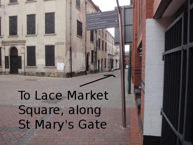
Leaving from the pedestrian entrance/exit onto Pilcher Gate, turn left, facing up the slope. Go up the slope to a T junction; this is St Mary’s Gate. Turn left onto St Mary’s Gate. (The building visible at the top of the slope is Stoney Street car park, described above.)
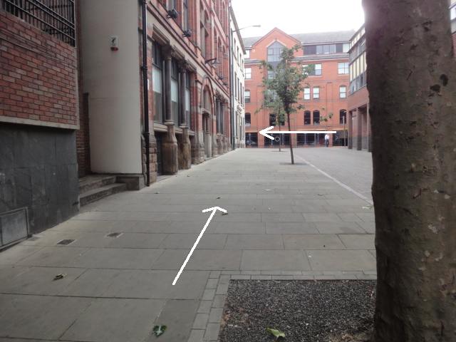
From then on, you’re on the same route as from the other car park; Lace Market Square is on your left.